The Automatic Identification System (AIS) is a short-range coastal tracking system currently used on ships. It was developed to provide identification and positioning information to both vessels and shore stations. Ships of 300 gross tonnage or more sailing on international voyages, cargo ships of 500 gross tonnage or more sailing in local waters, and all passenger ships irrespective of size are mandated by the International Maritime Organization (IMO) to carry AIS equipment. AIS transponders automatically broadcast information at regular intervals. Navigational status data is transmitted every 2 to 180 seconds, depending on a vessel's activity. In addition, voyage related data is broadcast every 6 minutes. These signals are received by AIS transponders installed on other ships or by land-based systems.
The AIS signals have a horizontal range of about 40 nautical miles (74 km), meaning that AIS traffic information is only available around coastal zones or in a ship-to-ship zone. AIS communication takes place using two VHF frequencies, 161.975 MHz and 162.025 MHz, using a bandwidth of 25 kHz. Although only one radio channel is necessary, each station transmits and receives over two radio channels to avoid interference problems, and to allow channels to be shifted among ships without loss of communication.
WHO
The following groups of users have been identified:
-Maritime security services: support of security operations, vessel traffic/navigation monitoring, vessel traffic management, support of safety operations
-Law-enforcement services: anti-piracy, illegal fishing, enforcement of international/ national regulations, support of enforcement operations
-Search and Rescue (SAR) services
-Maritime surveillance services: monitoring of vessels in sensitive areas, anti-drug smuggling, border control
-Environmental services: hazardous cargos monitoring, prevention of pollution caused by ships, pollution response
-Fleet management services for commercial users (shipping companies and ship owners)
WHAT
SAT-AIS is being developed through three ARTES programme elements:
ARTES 5 – Specific technology predevelopment activities, including antenna miniaturisation, receiver developments, and a performance testbed in the form of an end-to-end simulator.
ARTES 20 – Implementation and validation of a Data Processing Centre as “space node” in close cooperation with and co-funding from the European Maritime Safety Agency for full data integration into SafeSeaNet services.
ARTES 21 phase 1 – Initial steps of the system design and implementation, including estimating the economic potential by means of a cost-benefit analysis of an Operational Demonstration Mission (ODEM), system design studies, comparative performance assessments, as well the exploration of a possible Public Private Partnership (PPP) implementation scheme for the European SAT-AIS operational system.
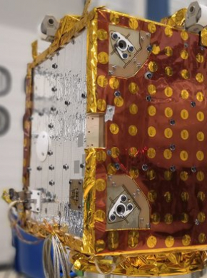
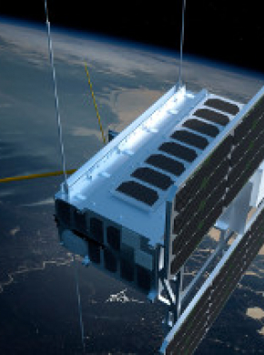
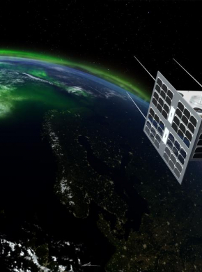
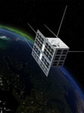
ARTES 21 phase 2 – covers the detailed design and implementation of the SAT-AIS microsatellites and payloads, and the development of innovative SAT-AIS applications and services. Following the system definition and trade-off analysis carried out in preliminary studies, a constellation of so-called microsatellites has been retained as the most cost-effective solution for providing SAT-AIS services and maintaining its viability. For this commercially-oriented project, called E-SAIL, LuxSpace will be the industrial prime contractor. In parallel, ESA is also developing a SAT-AIS payload for the forthcoming Norwegian NORSAT[CF1] -1 mission, which will also fly two additional scientific payloads. Kongsberg Seatex is the prime contractor responsible for defining the technical system requirements, the development, manufacturing, assembly, test and qualification of the Novel SAT-AIS Receiver, NAIS. The operator of the NORSAT-1 satellite will be the Norwegian Space Centre (NSC). NSC will be responsible for the top-level mission requirements.
FEATURED OPPORTUNITIES
ARTES 4.0 Pioneer Call for Proposals Opened
View details
NEWS AND EVENTS
ESAiL undergoes its final preparation for launch
The ESAIL microsatellite developed under ESA’s programme for tracking ships at sea is going through its final tests ahead of launch.
Maritime microsatellite ESAIL to test the waters as launch contract is signed
The first commercial microsatellite developed under ESA’s SAT‐AIS programme for tracking ships, called ESAIL, has passed another milestone. On 9 May its Canadian operator exactEarth signed the launch service agreement with Arianespace.
New Satellite-AIS payloads boost tracking of ships
Advanced Satellite-AIS payloads launched aboard Norwegian satellites last year has boosted the number of ships tracked by up to 70% and ship positions received by factor of three.
From satellites to the sea: VDES offers global link for ships
Norway-based test campaign for VDESC will be discussed at a related workshop on 16th of January, hosted at ESA’s technical centre in the Netherlands.
Norway launches advanced Satellite-AIS payloads to improve maritime shipping coverage
A compact Satellite-AIS receiver to monitor ships in the seas surrounding Norway is one of several payloads on Norway’s NorSat-1 and NorSat-2 microsatellites
Novel AIS receivers on their way
1 February 2016 – A new satellite to be launched in April by the Norwegian Space Centre (NSC) will include two AIS receivers that will improve the identification and tracking of ships anywhere on the seas.
Breakthrough in SAT-AIS antenna design
19 January 2016 – A new SAT-AIS antenna developed with the support of ESA combines higher-gain with a smaller footprint. Clever engineering has reduced its overall size so that up to five could be hosted on a single cubic-metre minisatellite.
VIDEO: safe at sea with satellites
27 October 2015 – At sea, space technology is used to help save lives every day: managing traffic between ships, picking up migrants and refugees in distress or spotting oil spills. Throught the ARTES programme, ESA is at the forefront developing…
Norwegian SAT-AIS payload delivered
10 July 2015 – Two Novel SAT-AIS receivers built by Kongsberg Seatex with support from ESA were delivered to the Norwegian Space Centre for launch on the Norsat-1 satellite in early 2016.
ESA announces a public–private partnership with LuxSpace of Luxembourg and exactEarth of Canada to develop a next-generation SAT-AIS satellite.
Space-AIS data service successfully delivered for efficient vessel tracking
An ESA project supporting the European Maritime Safety Agency´s (EMSA) Blue Belt pilot programme has successfully delivered space AIS data. More than 21,000 ships were detected and 14 million messages were processed during this demonstration.
Paper presented at 62nd International Astronautical Congress
This paper, prepared by ESA and EMSA, explains the European and International context for SAT-AIS, the process for user requirements, main key requirements and the SAT-AIS workplan.


